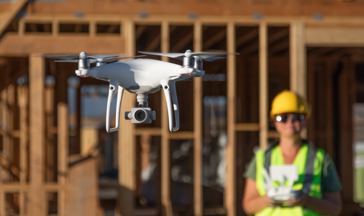
Professional Flying Equipment, Best Flying Tool For Aerial Work
No fear of wind and rain, march forward day and night
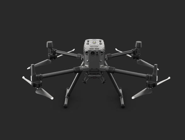
DJI Jingwei M300RTK UAV
DJI Jingwei M300RTK UAV
The M300 is the UAV with the strongest positioning and obstacle avoidance capabilities in the history of DJI. It has a 15KM image transmission control distance and multi-point control of the main and standby remote controllers. The 55-minute battery life and the hot-swappable battery system basically guarantee all-weather flight operations. And with IP45 waterproof, let the flight mission not afraid of wind and rain.
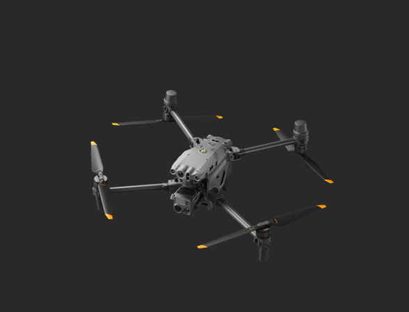
DJI Industrial Machine M30T
DJI Industrial Machine M30T
41 minutes of battery life, IP55 protection level. When the M300 is on the ground to change the battery, it will take over to take off. As an industrial machine, it also has technologies such as double safety redundancy and dual battery hot swap. The latest O3+ industry map biography is even more powerful.
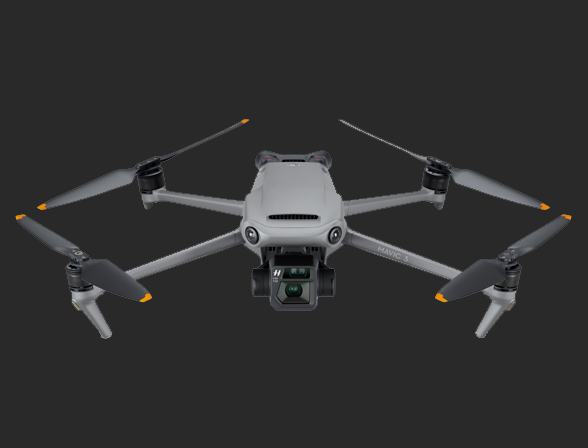
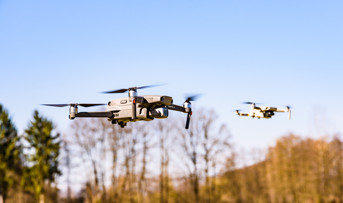
DJI Mavic 3
DJI Mavic 3
The dexterity of the small aircraft, the wind resistance of the Mavic 3, and the excellent video clarity are generally used by our UAV team as an alternative model for aerial photography missions.
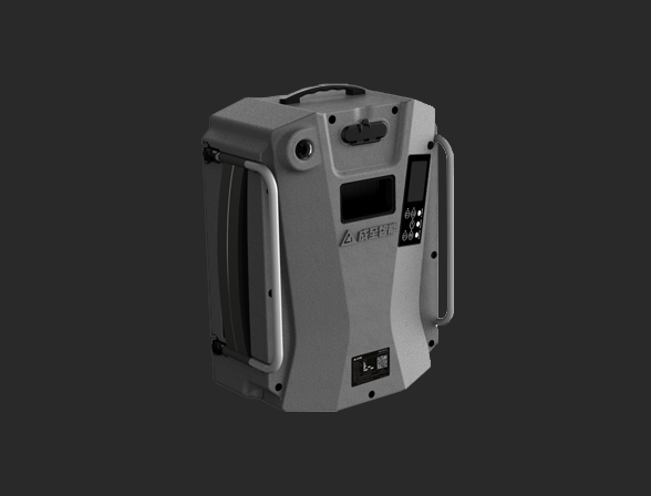
Ground Tethered Power Supply System
Ground Tethered Power Supply System
The M300's dual backup redundant safety system allows the drone to hover for a long time at a height of 110 meters in the air, meeting the needs of long-term large-area lighting and shouting.
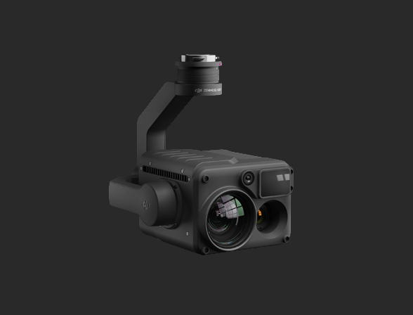
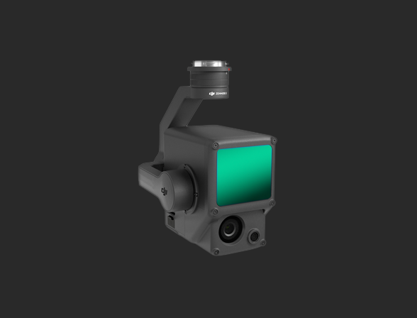
DJI Zenmuse H20T Lens
DJI Zenmuse H20T Lens
The 20-megapixel zoom camera supports up to 200x zoom, as well as thermal imaging, laser ranging, and wide-angle cameras. This is the most used load by the drone team in the field, because it can perform intelligent following, ranging, zooming and other operations, and it is the main force of our aerial inspection.
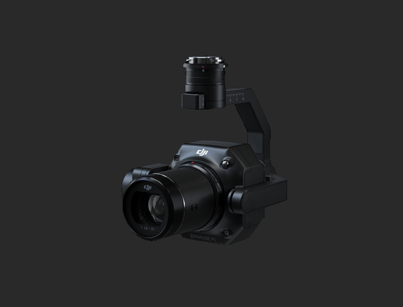
DJI Zenmuse P1 Lens
DJI Zenmuse P1 Lens
35MM full-frame sensor, 45 million pixels, the shortest continuous photo interval is 0.7 seconds, the aerial survey-free image control accuracy is 3cm, and the elevation accuracy is 5cm. It is the main modeling equipment of the M300. The unique intelligent swing greatly reduces the operating time in the field and lays the foundation for high-efficiency modeling tasks.
DJI Zenmuse L1 Lens
DJI Zenmuse L1 Lens
Laser point cloud imaging allows us to quickly obtain measurement data such as elevation in high-precision aerial survey tasks, and contribute to construction tasks.
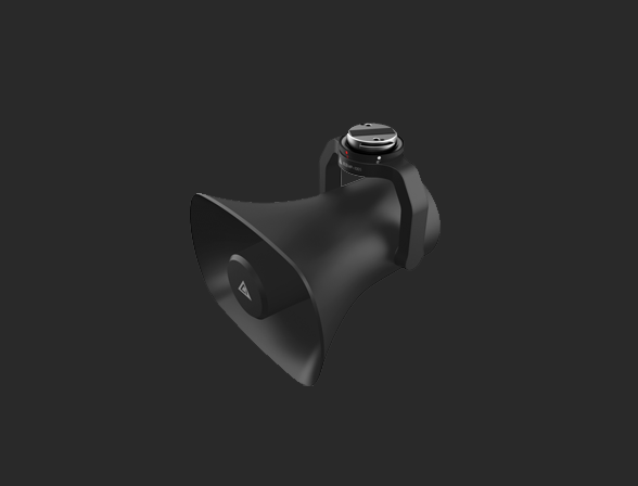
Chengzhi MP130S Megaphone
Chengzhi MP130S Megaphone
The sound pressure at 500 meters, 130 decibels, and the long-range link allows the M300 to perform shouting tasks in the sky.
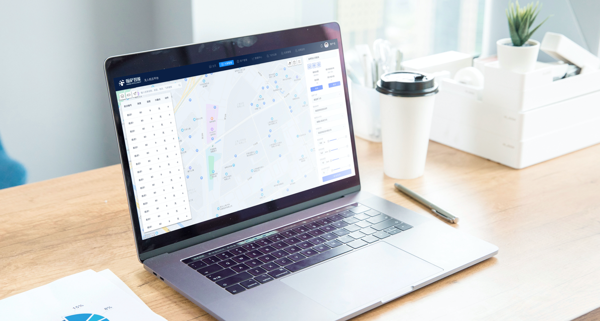
Self-developed Software System, Professional Cloud Platform
Real-time UAV image return within 1s delay; cloud recording, remote UAV control.
Hansa Drone Cloud Platform
Through the mobile communication network, combined with the storage, live distribution, voice transmission, statistics and other functions of the cloud platform, the real-time live broadcast, remote shouting, action pre-production, and flight statistics of UAV aerial photography are realized, and the scientific management of equipment, personnel and routes is realized.
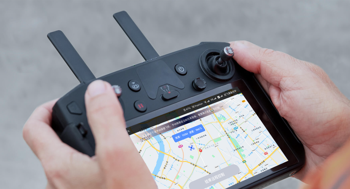
Hansa Drone Control APP
Connect to the Hansa UAV cloud platform to realize one-key take-off, landing, and taking photos; view the parameters of inorganic equipment, view the flight trajectory of the UAV based on the 2D map; view the real-time image of the UAV.
Why Choose Us
Exquisite technology joins hands with powerful equipment, reliable and secure.
More Than Ten Years Of Application Experience In The UAV Industry
Our core members have been engaged in technical support work in the field of drones for more than 10 years; with years of experience in the industry, they have developed ultra-feasible solutions and technical guidance for customers. An experienced development team provides emergency and professional development services for special situations.
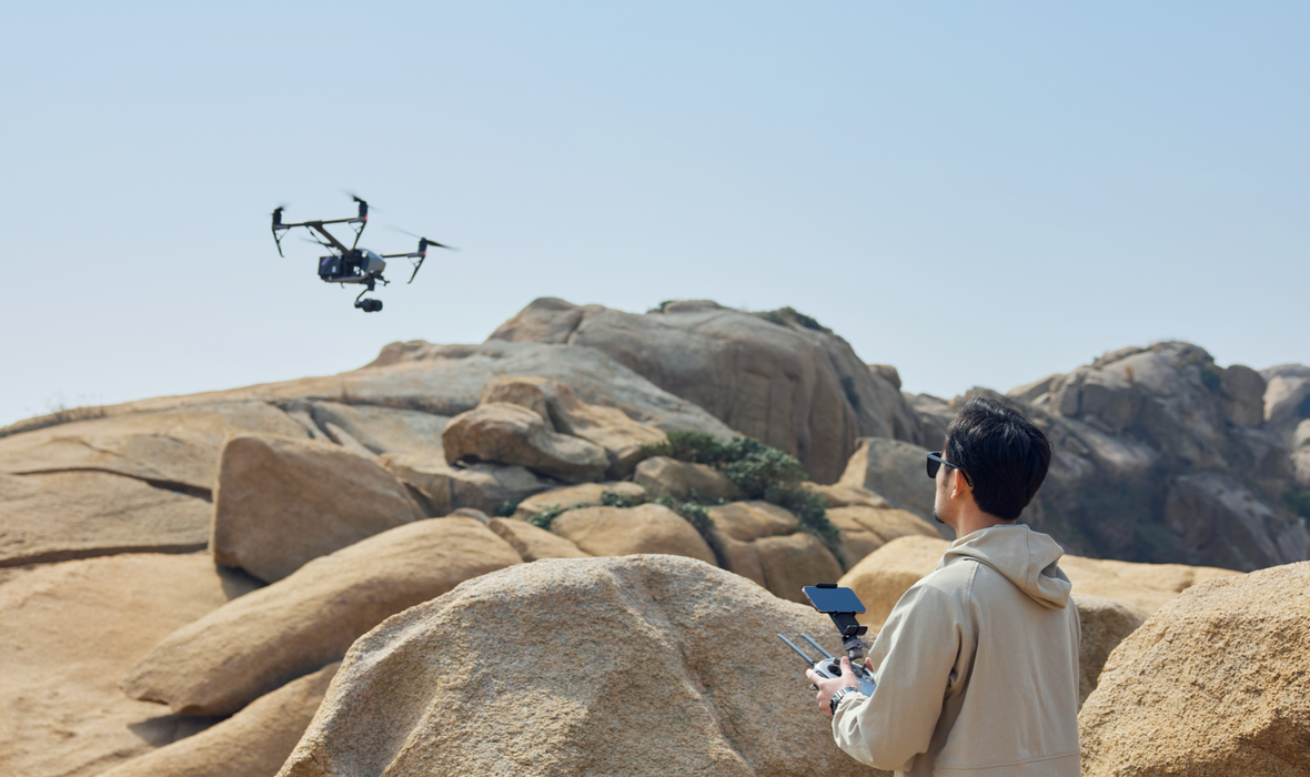
Professional Drone Team
We have a number of professional drone pilots, who are certified to work, have rich flying knowledge, operate safely and lawfully, and ensure the smooth progress of the operation tasks.
Self-Developed UAV Control System
The industry-level inspection platform, the real-time UAV image is delayed within 1s. Cloud recording enables remote control of drones.

Customized Solutions
According to the needs of customers and the pain points and difficulties of related industries, we provide professional and customized services, try our best to solve difficulties and meet customer needs.